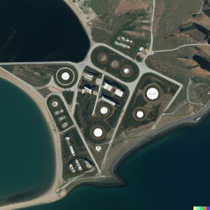
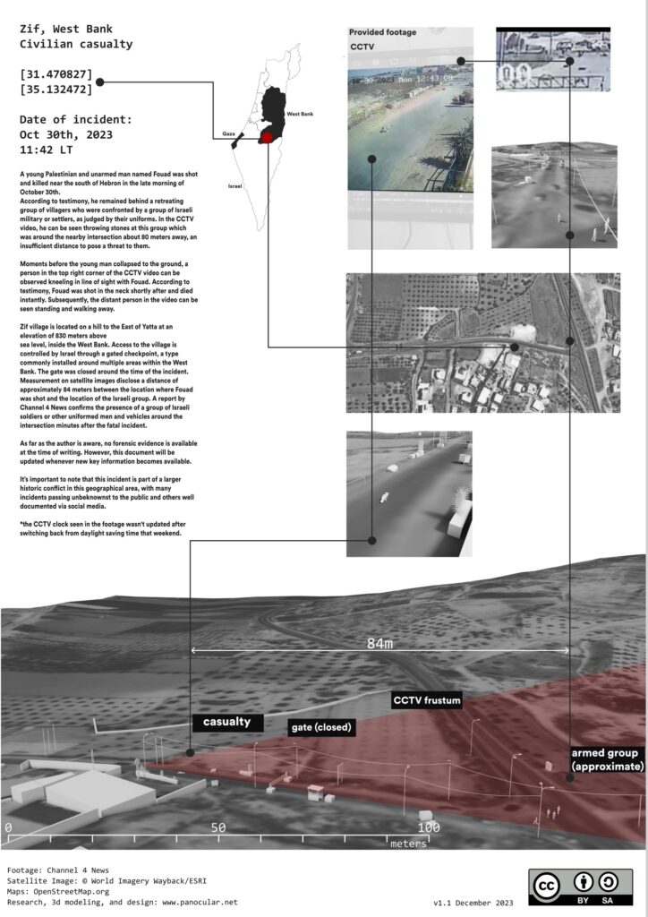
Zif, West Bank
Civilian Casualty
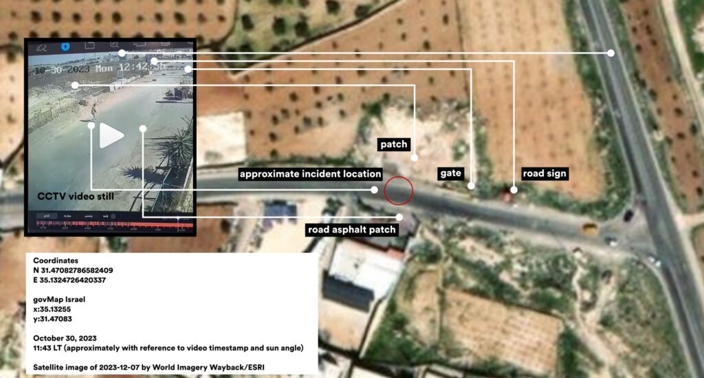
[31.470827]
[35.132472]
Date of incident:
Oct 30th, 2023
11:42 LT*
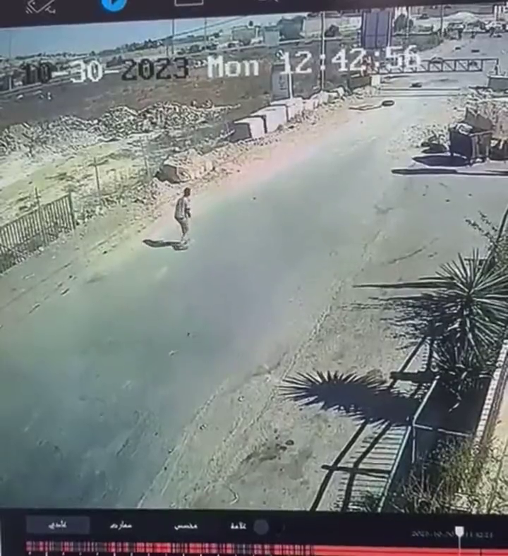
A young Palestinian and unarmed man named Fouad was shot and killed near the south of Hebron in the late morning of October 30th.
According to testimony, he remained behind a retreating group of villagers who were confronted by a group of Israeli military or settlers, as judged by their uniforms. In the CCTV video, he can be seen throwing stones at this group which was around the nearby intersection about 80 meters away, an insufficient distance to pose a threat to them.
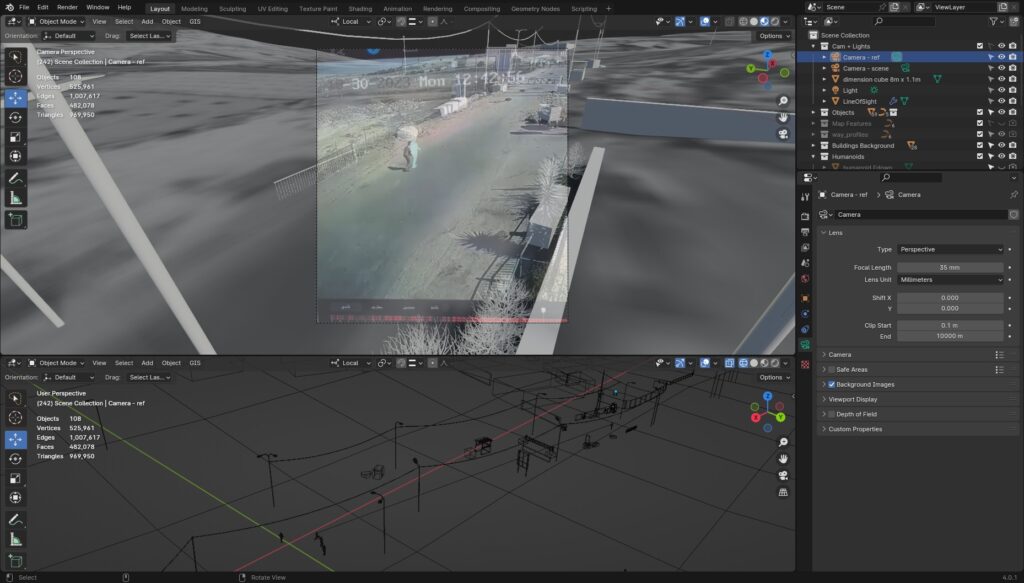
Moments before the young man collapsed to the ground, a person in the top right corner of the CCTV video can be observed kneeling in line of sight with Fouad. According to testimony, Fouad was shot in the neck shortly after and died instantly. Subsequently, the distant person in the video can be seen standing and walking away.
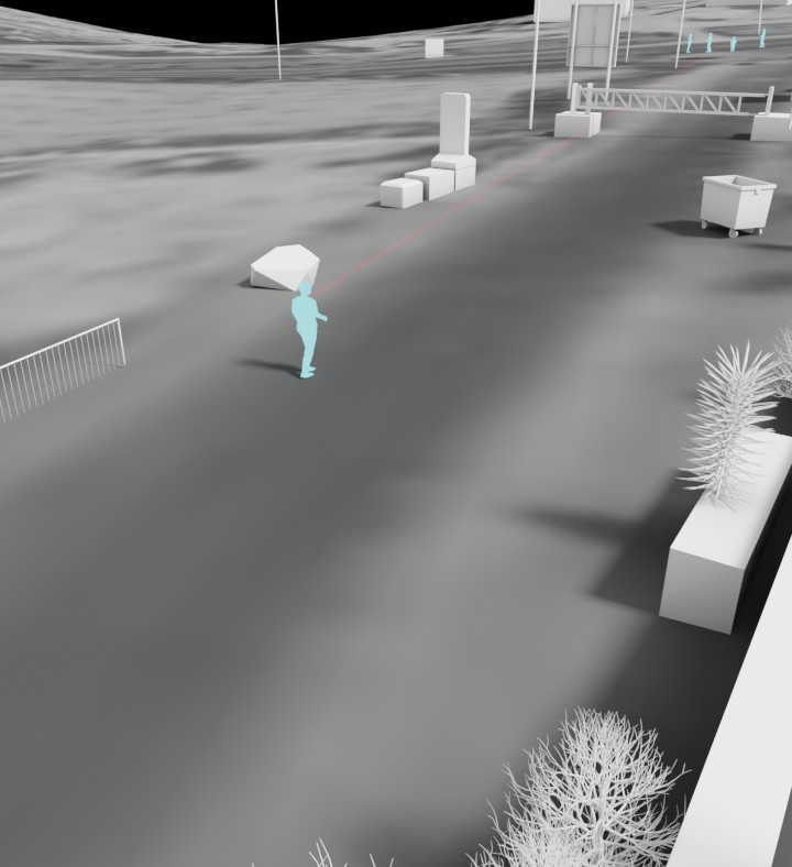
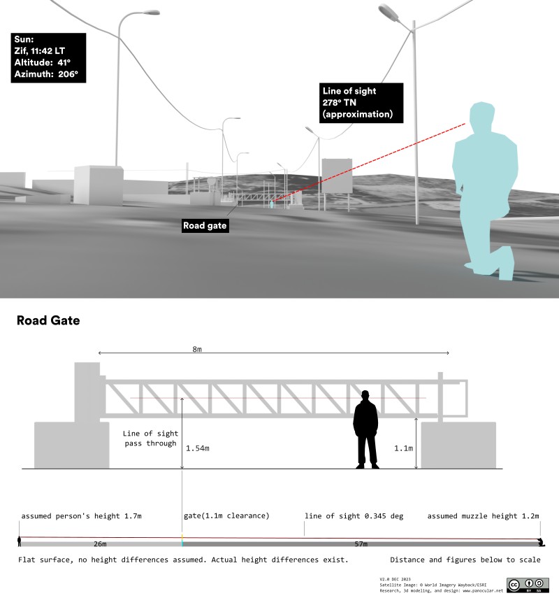
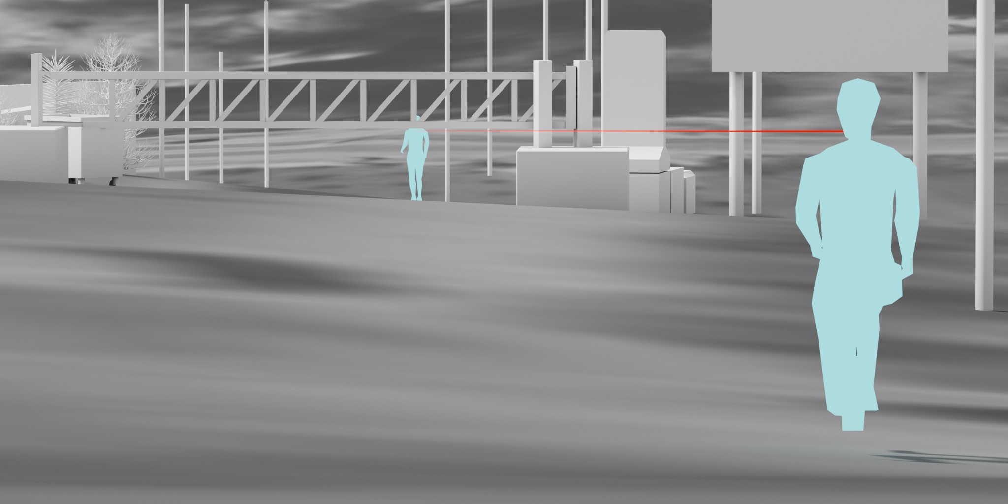
If the person in the distance was the shooter, they would have been separated about 83 meters apart. Assuming a flat surface, the line of fire would pass through the road gate at a height of 1.54 meters. Actual ground surface conditions differ however, and the actual line of fire may have been situated well under the gate.
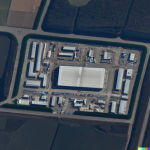
Zif village is located on a hill to the East of Yatta at an elevation of 830 meters above sea level, inside the West Bank. Access to the village is controlled by Israel through a gated checkpoint, a type commonly installed around multiple areas within the West Bank. The gate was closed around the time of the incident. Measurement on satellite images reveals a distance of approximately 84 meters between the location where Fouad was shot and the location of the Israeli group. A report by Channel 4 News confirms the presence of a group of Israeli soldiers or other uniformed men and vehicles around the intersection minutes after the fatal incident.
As far as the author is aware, no forensic evidence is available at the time of writing. However, this document will be updated whenever new key information becomes available.
It’s important to note that this incident is part of a larger historical conflict in this geographical area, with many incidents passing unbeknownst to the public and others well documented via social media.
*the CCTV clock seen in the footage wasn’t updated after switching back from daylight saving time that weekend.
Click here for the report in pdf format.
Below is a social media post shared by Channel 4 News, covering the incident within a broader context.
Acknowledgments and Copyrights
Channel 4 news
ESRI World Imagery Wayback
Google Maps
OpenStreetMap
Mapillary
www.channel4.com/
https://livingatlas.arcgis.co/wayback/
https://www.google.com/maps
https://www.openstreetmap.org
https://www.mapillary.com/